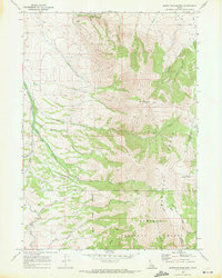
1968 Map of South Putnam Mtn
USGS Topo · Published 1972About this map
The Portneuf Range dominates this late-1960s landscape, rising to the heights of Mt Putnam and South Putnam Mtn along the border of Bannock and Caribou counties. The settlement of Barclay is positioned along the western foothills, where Ross Fork and Mill Creek emerge from the high country. This survey illustrates the convergence of different land management eras, showing the southern Fort Hall Indian Reservation Boundary meeting the northern edge of the Caribou National Forest. Local infrastructure is defined by specialized routes such as the Buck Skin Pack Trail and Mc Nab Road, which navigate the drainage basins of Thirty Day Creek and Rapid Creek. The map documents a period when access to these peaks relied on a network of jeep trails and historic pack routes through the basins.
Find a feature on this map
21 named features on this map. Tap any name to fly to it.
Don’t see what you’re looking for? This feature index may not catch every label — zoom into the map to look around manually.
Map Details
Editions of this 1968 South Putnam Mtn Map
This is the sole edition of this map. No revisions or reprints were ever made.
Other maps of this area

1937 · Pocatello
USGS Topo · 1:48,000

1940 · Blackfoot
USGS Topo · 1:62,500

1943 · Blackfoot
USGS Topo · 1:62,500

1944 · Pocatello
USGS Topo · 1:62,500

1954 · Pocatello
USGS Topo · 1:250,000

1955 · Yandell Springs
USGS Topo · 1:62,500

1955 · Idaho Falls
USGS Topo · 1:250,000

1958 · Idaho Falls
USGS Topo · 1:250,000

1958 · Pocatello
USGS Topo · 1:250,000

1968 · Bear Camp Gulch
USGS Topo · 1:24,000