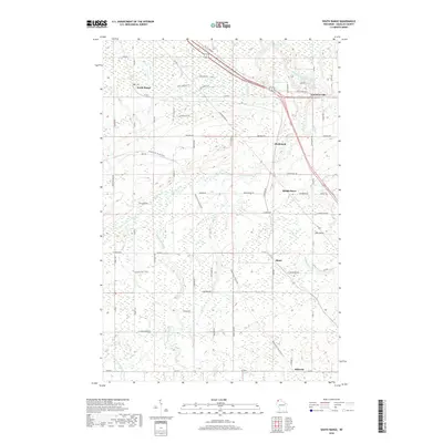
2018 Map of South Range
USGS Topo · Published 2018About this map
South Range and the surrounding Douglas County landscape are defined by a complex network of waterways and early transportation corridors. The Amnicon River and its various tributaries, including the Little Amnicon River and Silver Cr, carve through the terrain, supporting small communities like Middle River and Hines. The region's history is reflected in its infrastructure, where the Tri Co Corridor and the Wild Rivers State Trail utilize former rail beds to traverse the countryside. These trails connect older settlements such as Rockmont and Hillcrest with natural landmarks like Amnicon Falls. The map reveals a transition from the structured street grids of South Range to the more dispersed residential patterns along family-named roads like Mabel Nelson Rd and Sam Anderson Rd, illustrating the rural development of northern Wisconsin.
Find a feature on this map
70 named features on this map. Tap any name to fly to it.
Don’t see what you’re looking for? This feature index may not catch every label — zoom into the map to look around manually.
Map Details
Editions of this 2018 South Range Map
This is the sole edition of this map. No revisions or reprints were ever made.
Other maps of this area

1915 · Superior
USGS Topo · 1:48,000

1917 · Superior
USGS Topo · 1:62,500

1945 · Solon Springs
USGS Topo · 1:48,000

1949 · Solon Springs
USGS Topo · 1:48,000

1949 · Patzau
USGS Topo · 1:48,000

1949 · Poplar
USGS Topo · 1:48,000

1953 · Ashland
USGS Topo · 1:250,000

1953 · Duluth
USGS Topo · 1:250,000

1954 · Sunnyside
USGS Topo · 1:24,000
1954 · Superior
USGS Topo · 1:24,000