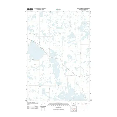
2012 Map of South Red Iron Lake
USGS Topo · Published 2012About this map
Glacial prairie potholes and a complex network of freshwater basins define this Marshall County landscape. The topography is dominated by the connected waters of North Red Iron Lake and South Red Iron Lake, flanked to the west by the expansive Clear Lake. This region of South Dakota is characterized by its high density of named water bodies, ranging from the large Buffalo Lakes in the southeast to smaller, secluded basins like Turtlefoot Lake and Goodbird Lake.
Find a feature on this map
41 named features on this map. Tap any name to fly to it.
Don’t see what you’re looking for? This feature index may not catch every label — zoom into the map to look around manually.
Map Details
Editions of this 2012 South Red Iron Lake Map
This is the sole edition of this map. No revisions or reprints were ever made.
Other maps of this area

1953 · Milbank
USGS Topo · 1:250,000

1958 · Milbank
USGS Topo · 1:250,000

1958 · Hillhead
USGS Topo · 1:24,000

1958 · Veblen
USGS Topo · 1:24,000

1964 · Claire City SW
USGS Topo · 1:24,000

1970 · Eden
USGS Topo · 1:24,000

1970 · Whitestone Lake
USGS Topo · 1:24,000

1970 · South Red Iron Lake
USGS Topo · 1:24,000

1970 · Lake City
USGS Topo · 1:24,000

1970 · Piyas Lake
USGS Topo · 1:24,000