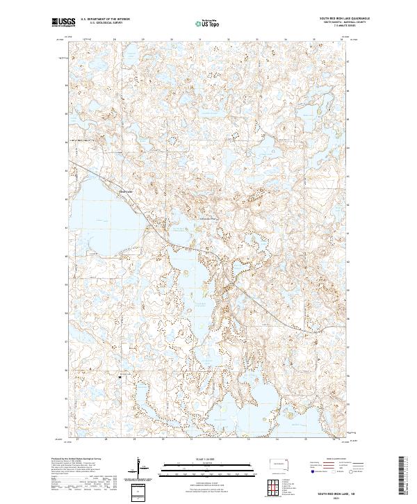
2021 Map of South Red Iron Lake
USGS Topo · Published 2021About this map
The Coteau des Prairies plateau forms the backdrop for this lake-strewn landscape in Marshall County, dominated by a long chain of glacial basins. The topography is defined by the central corridor of North Red Iron Lake and South Red Iron Lake, which are flanked by numerous smaller bodies of water including Josephine Lake, Almos Lake, and Lake Isabella. Human settlement patterns are scattered, primarily concentrated around the northern shores of Clear Lake and along rural routes like Co HWY 10 and 444th Ave. Genealogists will find the Old Eden Cem located south of the main lakes, serving as a landmark for the historical community. The map reveals a transition from these large water bodies to more marshy terrain at Pete W Slough and Meyer Slough, illustrating the complex hydrology of the Glacial Lakes region.
Find a feature on this map
47 named features on this map. Tap any name to fly to it.
Don’t see what you’re looking for? This feature index may not catch every label — zoom into the map to look around manually.
Map Details
Editions of this 2021 South Red Iron Lake Map
This is the sole edition of this map. No revisions or reprints were ever made.
Other maps of this area

1953 · Milbank
USGS Topo · 1:250,000

1958 · Milbank
USGS Topo · 1:250,000

1958 · Hillhead
USGS Topo · 1:24,000

1958 · Veblen
USGS Topo · 1:24,000

1964 · Claire City SW
USGS Topo · 1:24,000

1970 · Eden
USGS Topo · 1:24,000

1970 · Whitestone Lake
USGS Topo · 1:24,000

1970 · South Red Iron Lake
USGS Topo · 1:24,000

1970 · Lake City
USGS Topo · 1:24,000

1970 · Piyas Lake
USGS Topo · 1:24,000