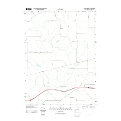
2013 Map of South Ripley
USGS Topo · Published 2013About this map
South Ripley and the surrounding rural hamlets of Chautauqua County are defined by a network of creeks and small settlements in the early twenty-first century. The landscape is carved by the northern reaches of Twentymile Cr and the W Br French Cr, which drain the undulating terrain near the Pennsylvania border. This topography has long influenced the placement of local roads like NE Sherman Rd and Sulphur Springs Rd, which connect the small clusters of homes and farms that make up Wattlesburg and Sheldon Corners.
Find a feature on this map
46 named features on this map. Tap any name to fly to it.
Don’t see what you’re looking for? This feature index may not catch every label — zoom into the map to look around manually.
Map Details
Editions of this 2013 South Ripley Map
This is the sole edition of this map. No revisions or reprints were ever made.
Other maps of this area

1899 · Westfield
USGS Topo · 1:62,500

1905 · Clymer
USGS Topo · 1:62,500

1913 · North East
USGS Topo · 1:62,500

1915 · North East
USGS Topo · 1:62,500

1939 · Clymer
USGS Topo · 1:62,500

1941 · Clymer
USGS Topo · 1:62,500

1943 · North East
USGS Topo · 1:62,500

1954 · South Ripley
USGS Topo · 1:24,000

1954 · Ripley
USGS Topo · 1:24,000
1954 · Clymer
USGS Topo · 1:24,000