
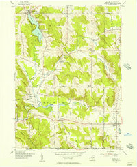
2019 Map of South Ripley
USGS Topo · Published 2019About this map
South Ripley and the surrounding Chautauqua County uplands are defined by a network of rural routes and the deep incision of Gage Gulf to the north. This modern landscape reveals a distinct pattern of 19th-century settlement cores, such as Wattlesburg and Mina, which remain anchored by historic burial sites like Mina Cem and South Ripley Cem. The terrain is shaped by the Continental Divide, a fact noted by the presence of Pratt's Eastern Divide Airport situated near the headwaters of the W Br French Cr. Significant drainage systems including Twentymile Cr and Nelson Cr carve through the plateau, while the southern portion of the quadrangle opens into the low-lying Beaver Marsh. The transport network, from the local NE Sherman Rd to the regional thoroughfares, illustrates the enduring spatial organization of this agricultural and wooded borderland.
Find a feature on this map
49 named features on this map. Tap any name to fly to it.
Don’t see what you’re looking for? This feature index may not catch every label — zoom into the map to look around manually.
Map Details
Editions of this 2019 South Ripley Map
This is the sole edition of this map. No revisions or reprints were ever made.
Other maps of this area

1899 · Westfield
USGS Topo · 1:62,500

1905 · Clymer
USGS Topo · 1:62,500

1913 · North East
USGS Topo · 1:62,500

1915 · North East
USGS Topo · 1:62,500

1939 · Clymer
USGS Topo · 1:62,500

1941 · Clymer
USGS Topo · 1:62,500

1943 · North East
USGS Topo · 1:62,500

1954 · South Ripley
USGS Topo · 1:24,000

1954 · Ripley
USGS Topo · 1:24,000
1954 · Clymer
USGS Topo · 1:24,000