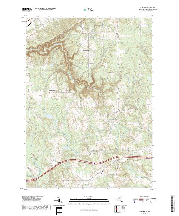
2023 Map of South Ripley
USGS Topo · Published 2023About this map
Wattlesburg and South Ripley anchor this high-plateau landscape in western New York, where the headwaters of several drainages begin their descent toward Lake Erie or the Allegheny River system. The deep incision of Gage Gulf in the northwest contrasts with the broader, marshy valleys of the south, specifically around Beaver Marsh near the settlement of Mina. Local history and genealogy are well-represented by the South Ripley Cem and Mina Cem, while the aviation legacy of the region is marked by Pratt's Eastern Divide Airport situated near the drainage divide. The network of rural roads, such as Sherman Rd and Sinden Rd, follows the rolling topography, tracing the paths of long-established farmsteads and the winding courses of Twentymile Creek and the West Branch French Creek.
Find a feature on this map
55 named features on this map. Tap any name to fly to it.
Don’t see what you’re looking for? This feature index may not catch every label — zoom into the map to look around manually.
Map Details
Editions of this 2023 South Ripley Map
This is the sole edition of this map. No revisions or reprints were ever made.
Other maps of this area

1899 · Westfield
USGS Topo · 1:62,500

1905 · Clymer
USGS Topo · 1:62,500

1913 · North East
USGS Topo · 1:62,500

1915 · North East
USGS Topo · 1:62,500

1939 · Clymer
USGS Topo · 1:62,500

1941 · Clymer
USGS Topo · 1:62,500

1943 · North East
USGS Topo · 1:62,500

1954 · South Ripley
USGS Topo · 1:24,000

1954 · Ripley
USGS Topo · 1:24,000
1954 · Clymer
USGS Topo · 1:24,000