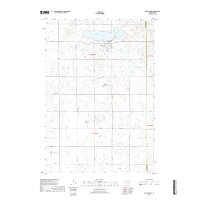
2017 Map of South Shore
USGS Topo · Published 2017About this map
South Shore sits atop the glacial highland of the Coteau des Prairies, a prominent plateau landscape that shapes the hydrology of this South Dakota region. The town is situated on the southern bank of Punished Womans Lake, which, along with the adjacent Round Lake, feeds the headwaters of the N Fork Yellow Bank River. This 2017 survey reveals a grid of rural section-line roads, such as 464th Ave and 157th St, typical of the Great Plains' agricultural development. Genealogists and local historians will find significant landmarks including Lakeview Cem on the northern edge of the settlement and the remote Jellis Grave to the southwest. The geography is further marked by the Punished Womans Mound, a high point south of the lake, and the meandering course of Mud Cr through the western sections of the township.
Find a feature on this map
37 named features on this map. Tap any name to fly to it.
Don’t see what you’re looking for? This feature index may not catch every label — zoom into the map to look around manually.
Map Details
Editions of this 2017 South Shore Map
This is the sole edition of this map. No revisions or reprints were ever made.
Other maps of this area

1953 · Milbank
USGS Topo · 1:250,000

1953 · Watertown
USGS Topo · 1:250,000

1958 · Milbank
USGS Topo · 1:250,000

1958 · Watertown
USGS Topo · 1:250,000

1969 · Watertown East
USGS Topo · 1:24,000

1970 · Kranzburg
USGS Topo · 1:24,000

1970 · Goodwin
USGS Topo · 1:24,000

1970 · Still Lake SE
USGS Topo · 1:24,000

1970 · Still Lake NE
USGS Topo · 1:24,000

1973 · Twin Brooks
USGS Topo · 1:24,000