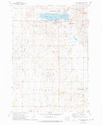
1973 Map of South Shore
USGS Topo · Published 1976About this map
Punished Womans Lake and the nearby Punished Womans Mound dominate the landscape of northeastern Codington County in this mid-1970s survey. The village of South Shore sits at the southern edge of the lake, served by the Burlington Northern railroad. The surrounding prairie is defined by a dense network of conservation lands, including the Hanson State Public Shooting Area and the Troy Lake State Public Shooting Area, reflecting the region's importance for waterfowl and upland game management.
Find a feature on this map
21 named features on this map. Tap any name to fly to it.
Don’t see what you’re looking for? This feature index may not catch every label — zoom into the map to look around manually.
Map Details
Editions of this 1973 South Shore Map
This is the sole edition of this map. No revisions or reprints were ever made.
Other maps of this area

1953 · Milbank
USGS Topo · 1:250,000

1953 · Watertown
USGS Topo · 1:250,000

1958 · Milbank
USGS Topo · 1:250,000

1958 · Watertown
USGS Topo · 1:250,000

1969 · Watertown East
USGS Topo · 1:24,000

1970 · Kranzburg
USGS Topo · 1:24,000

1970 · Goodwin
USGS Topo · 1:24,000

1970 · Still Lake SE
USGS Topo · 1:24,000

1970 · Still Lake NE
USGS Topo · 1:24,000

1973 · Twin Brooks
USGS Topo · 1:24,000