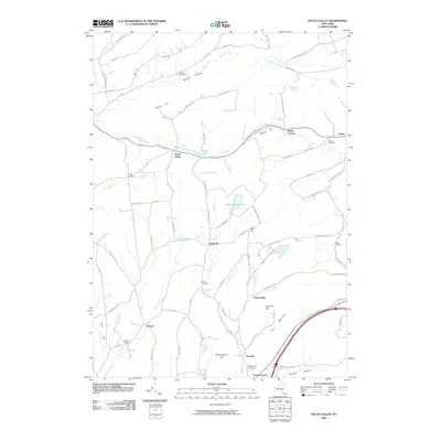
2010 Map of South Valley
USGS Topo · Published 2010About this map
South Valley serves as a central point in this rural landscape, where the upland terrain of Honey Hill and Pine Mountain is carved by numerous watercourses. The drainage patterns of Pleasant Brook and Snyder Creek define the northern reaches, while Decatur Creek and Oak Creek flow through the southern valleys toward the Schenevus Creek corridor. Small hamlets like Gothicville, Furnaceville, and Calcutta appear along the local road network, suggesting a history of decentralized settlement and small-scale industry. Genealogists will find significant value in the distribution of family-named burial sites, including the Sissum Cemetery, Ferris Cemetery, and Houck Cemetery, which are scattered across the hillsides far from the larger village centers. The presence of Stone Quarry Hill and several prominent hills like Elliot Hill indicates a landscape shaped by both its geological resources and its agricultural heritage.
Find a feature on this map
88 named features on this map. Tap any name to fly to it.
Don’t see what you’re looking for? This feature index may not catch every label — zoom into the map to look around manually.
Map Details
Editions of this 2010 South Valley Map
This is the sole edition of this map. No revisions or reprints were ever made.
Other maps of this area

1898 · Canajoharie
USGS Topo · 1:62,500

1900 · Canajoharie
USGS Topo · 1:62,500

1902 · Canajoharie
USGS Topo · 1:62,500

1903 · Richfield Springs
USGS Topo · 1:62,500

1904 · Richmondville
USGS Topo · 1:62,500

1907 · Cooperstown
USGS Topo · 1:62,500

1909 · Cooperstown
USGS Topo · 1:62,500

1943 · South Valley
USGS Topo · 1:24,000

1943 · Sharon Springs
USGS Topo · 1:24,000
1943 · Sprout Brook
USGS Topo · 1:24,000