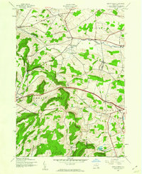
1943 Map of Sprout Brook
USGS Topo · Published 1960About this map
Salt Springville and Sharon Springs anchor the corners of this upland territory where the borders of Montgomery, Otsego, and Schoharie counties meet. The landscape is defined by the headwaters of Canajoharie Creek and Bowmans Creek, which carve valleys through the high ground of Cherry Valley and Sharon. This 1943 survey captures the rural infrastructure of the mid-century, documenting a dense network of district schools such as School No 13 and School No 3 that served scattered farmsteads. The Delaware and Hudson railroad cuts through the terrain, connecting the valley settlements of Leesville and Cherry Valley to wider markets. Family history is preserved in small burial grounds like McFee Cem and Flint Cem, which sit alongside established hamlets like Sprout Brook and Van Deusenville.
Find a feature on this map
34 named features on this map. Tap any name to fly to it.
Don’t see what you’re looking for? This feature index may not catch every label — zoom into the map to look around manually.
Map Details
Editions of this 1943 Sprout Brook Map
3 editions found
Other maps of this area

1898 · Canajoharie
USGS Topo · 1:62,500

1900 · Canajoharie
USGS Topo · 1:62,500

1902 · Canajoharie
USGS Topo · 1:62,500

1903 · Richfield Springs
USGS Topo · 1:62,500

1904 · Richmondville
USGS Topo · 1:62,500

1907 · Cooperstown
USGS Topo · 1:62,500

1909 · Cooperstown
USGS Topo · 1:62,500

1943 · South Valley
USGS Topo · 1:24,000

1943 · Sharon Springs
USGS Topo · 1:24,000

1943 · Westford
USGS Topo · 1:24,000