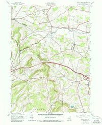
1943 Map of Sprout Brook
USGS Topo · Published 1988About this map
Salt Springville and Sprout Brook anchor this 1943 topographical study, which captures the rural character of the region where Otsego, Montgomery, and Schoharie Counties meet. The landscape is defined by the high ridges of Cherry Valley and Minden, with a network of local roads and the Delaware and Hudson corridor facilitating movement between small upland farming communities. Evidence of early settlement is pervasive in the distribution of family-named burial grounds like Flint Cem and McFee Cem, alongside a surviving system of rural education represented by numbered landmarks such as School No 13 and School No 3. In the southeastern corner, the higher elevations descend toward the village of Sharon Springs, while to the north, Canajoharie Creek and Bowmans Creek carve paths through the rolling terrain, illustrating the valley-based settlement patterns of the mid-20th century.
Find a feature on this map
34 named features on this map. Tap any name to fly to it.
Don’t see what you’re looking for? This feature index may not catch every label — zoom into the map to look around manually.
Map Details
Editions of this 1943 Sprout Brook Map
3 editions found
Other maps of this area

1898 · Canajoharie
USGS Topo · 1:62,500

1900 · Canajoharie
USGS Topo · 1:62,500

1902 · Canajoharie
USGS Topo · 1:62,500

1903 · Richfield Springs
USGS Topo · 1:62,500

1904 · Richmondville
USGS Topo · 1:62,500

1907 · Cooperstown
USGS Topo · 1:62,500

1909 · Cooperstown
USGS Topo · 1:62,500

1943 · South Valley
USGS Topo · 1:24,000

1943 · Sharon Springs
USGS Topo · 1:24,000
1943 · Sprout Brook
USGS Topo · 1:24,000