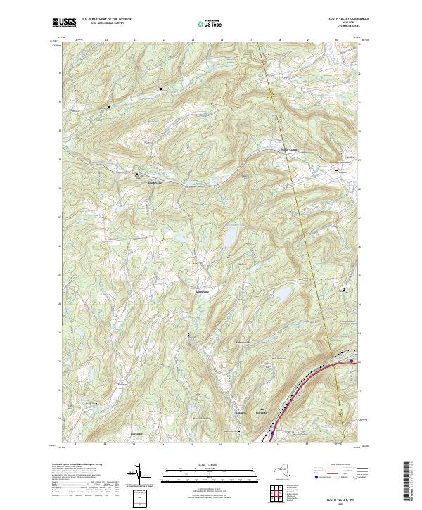
2023 Map of South Valley
USGS Topo · Published 2023About this map
Worcester and East Worcester anchor the southern reaches of this landscape, situated along the corridor where Interstate 84 follows the path of Cobleskill Creek. The terrain to the north is defined by a series of prominent elevations, including Pine Mountain, Honey Hill, and Weaver Hill, interspersed with small settlements such as South Valley, Decatur, and Gothicville. The network of local roads, like Gage School House Rd and Morton Rd, connects numerous family cemeteries and hollows that reflect the long-standing agricultural and rural residential character of Otsego County.
Find a feature on this map
101 named features on this map. Tap any name to fly to it.
Don’t see what you’re looking for? This feature index may not catch every label — zoom into the map to look around manually.
Map Details
Editions of this 2023 South Valley Map
This is the sole edition of this map. No revisions or reprints were ever made.
Other maps of this area

1898 · Canajoharie
USGS Topo · 1:62,500

1900 · Canajoharie
USGS Topo · 1:62,500

1902 · Canajoharie
USGS Topo · 1:62,500

1903 · Richfield Springs
USGS Topo · 1:62,500

1904 · Richmondville
USGS Topo · 1:62,500

1907 · Cooperstown
USGS Topo · 1:62,500

1909 · Cooperstown
USGS Topo · 1:62,500

1943 · South Valley
USGS Topo · 1:24,000

1943 · Sharon Springs
USGS Topo · 1:24,000
1943 · Sprout Brook
USGS Topo · 1:24,000