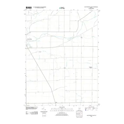
2010 Map of South Whitley East
USGS Topo · Published 2010About this map
South Whitley sits at the western edge of this landscape, where the Eel River and Spring Creek converge. The terrain is defined by a dense network of agricultural drainage, including the Williamson Ditch and Lehman Ditch, which support the surrounding farmsteads of Whitley County. These waterways feed into larger systems like Sugar Creek and Hurricane Creek, illustrating the complex hydrology of the Indiana countryside.
Find a feature on this map
48 named features on this map. Tap any name to fly to it.
Don’t see what you’re looking for? This feature index may not catch every label — zoom into the map to look around manually.
Map Details
Editions of this 2010 South Whitley East Map
This is the sole edition of this map. No revisions or reprints were ever made.
Other maps of this area

1950 · Pierceton
USGS Topo · 1:24,000

1953 · Fort Wayne
USGS Topo · 1:250,000

1953 · Muncie
USGS Topo · 1:250,000

1955 · Bippus
USGS Topo · 1:24,000

1955 · Columbia City
USGS Topo · 1:24,000

1956 · Muncie
USGS Topo · 1:250,000

1956 · Fort Wayne
USGS Topo · 1:250,000

1956 · Huntington
USGS Topo · 1:24,000

1956 · Lorane
USGS Topo · 1:24,000
1961 · Servia
USGS Topo · 1:24,000