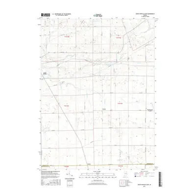
2016 Map of South Whitley East
USGS Topo · Published 2016About this map
The Eel River flows through the northern reaches of this landscape near the community of South Whitley, defining a region shaped by its intricate drainage network. The terrain is characterized by a sophisticated system of engineered waterways like Gable Ditch and Compton Ditch that support the agricultural productivity of the Whitley Co and Huntington Co borderlands. Smaller rural centers such as Tunker, Luther, and Washington Center anchor the grid of country roads, representing the enduring settlement patterns of the mid-20th century.
Find a feature on this map
46 named features on this map. Tap any name to fly to it.
Don’t see what you’re looking for? This feature index may not catch every label — zoom into the map to look around manually.
Map Details
Editions of this 2016 South Whitley East Map
This is the sole edition of this map. No revisions or reprints were ever made.
Other maps of this area

1950 · Pierceton
USGS Topo · 1:24,000

1953 · Fort Wayne
USGS Topo · 1:250,000

1953 · Muncie
USGS Topo · 1:250,000

1955 · Bippus
USGS Topo · 1:24,000

1955 · Columbia City
USGS Topo · 1:24,000

1956 · Muncie
USGS Topo · 1:250,000

1956 · Fort Wayne
USGS Topo · 1:250,000

1956 · Huntington
USGS Topo · 1:24,000

1956 · Lorane
USGS Topo · 1:24,000
1961 · Servia
USGS Topo · 1:24,000