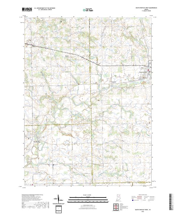
2022 Map of South Whitley West
USGS Topo · Published 2022About this map
The Eel River meanders across this landscape, connecting the small communities of Collamer and South Whitley as it flows through the heart of northern Indiana. This survey captures a rural environment defined by its intricate drainage network, featuring Mishler Ditch, Hurricane Cr, and Simonton Cr which carve through the agricultural townships. Local heritage is grounded in sites like Liberty Mills at the southwestern corner and the scattered cemeteries that serve as touchstones for area families, including Circle Cem, Glenwood Cem, and Union Cem. The map illustrates the persistent grid of county roads, such as W State Rd 14 and Eel River Rd, which link isolated settlements like Kinsey and Sidney to the regional centers. Small water bodies like Heckman Lake and T Lake dot the terrain, providing natural landmarks amidst the surveyed sections.
Find a feature on this map
65 named features on this map. Tap any name to fly to it.
Don’t see what you’re looking for? This feature index may not catch every label — zoom into the map to look around manually.
Map Details
Editions of this 2022 South Whitley West Map
This is the sole edition of this map. No revisions or reprints were ever made.
Other maps of this area

1950 · Pierceton
USGS Topo · 1:24,000

1953 · Fort Wayne
USGS Topo · 1:250,000

1953 · Muncie
USGS Topo · 1:250,000

1955 · Bippus
USGS Topo · 1:24,000

1956 · Muncie
USGS Topo · 1:250,000

1956 · Fort Wayne
USGS Topo · 1:250,000

1956 · Lorane
USGS Topo · 1:24,000

1957 · Warsaw
USGS Topo · 1:24,000
1961 · Servia
USGS Topo · 1:24,000
1961 · North Manchester South
USGS Topo · 1:24,000