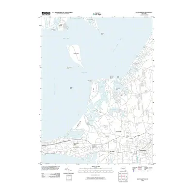
2010 Map of Southampton
USGS Topo · Published 2010About this map
Shinnecock Hills and the surrounding coastline of the South Fork define this landscape, where the Atlantic's influence meets the sheltered waters of Great Peconic Bay and Little Peconic Bay. The village of Southampton serves as a focal point, characterized by its historical layout and concentration of significant burial grounds, including the Old Southampton Cemetery and North End Cemetery. The map illustrates a complex coastal geography of necks and points, such as Cow Neck and Sebonac Neck, which separate numerous ponds and harbors. Educational and recreational land use is prominent, evidenced by the Southampton College Long Island University campus and the established fairways of the National Golf Links of America. This survey captures the area’s late 20th-century character, balancing dense residential pockets like Art Village and North Sea with the preserved natural features of Robins Island.
Find a feature on this map
74 named features on this map. Tap any name to fly to it.
Don’t see what you’re looking for? This feature index may not catch every label — zoom into the map to look around manually.
Map Details
Editions of this 2010 Southampton Map
This is the sole edition of this map. No revisions or reprints were ever made.
Other maps of this area

1903 · Sag Harbor
USGS Topo · 1:62,500

1903 · Riverhead
USGS Topo · 1:62,500

1904 · Sag Harbor
USGS Topo · 1:62,500

1904 · Shelter Island
USGS Topo · 1:62,500

1904 · Riverhead
USGS Topo · 1:62,500

1943 · Riverhead
USGS Topo · 1:62,500

1946 · Sag Harbor
USGS Topo · 1:24,000

1947 · Mattituck
USGS Topo · 1:24,000

1947 · Mattituck Hills
USGS Topo · 1:24,000

1947 · Southold
USGS Topo · 1:24,000