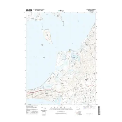
2016 Map of Southampton
USGS Topo · Published 2016About this map
Southampton and its surrounding coastal hamlets occupy this landscape where the Atlantic meets the intricate bays of eastern Long Island. The map details a transition from the historic village center to the outlying necks and points, including Art Village and the high ground of Shinnecock Hills. Water defines the geography, with Robins Island positioned between North Race and South Race, while the mainland is carved by Scallop Pond, Big Fresh Pond, and Agawam Lake.
Find a feature on this map
189 named features on this map. Tap any name to fly to it.
Don’t see what you’re looking for? This feature index may not catch every label — zoom into the map to look around manually.
Map Details
Editions of this 2016 Southampton Map
This is the sole edition of this map. No revisions or reprints were ever made.
Other maps of this area

1903 · Sag Harbor
USGS Topo · 1:62,500

1903 · Riverhead
USGS Topo · 1:62,500

1904 · Sag Harbor
USGS Topo · 1:62,500

1904 · Shelter Island
USGS Topo · 1:62,500

1904 · Riverhead
USGS Topo · 1:62,500

1943 · Riverhead
USGS Topo · 1:62,500

1946 · Sag Harbor
USGS Topo · 1:24,000

1947 · Mattituck
USGS Topo · 1:24,000

1947 · Mattituck Hills
USGS Topo · 1:24,000

1947 · Southold
USGS Topo · 1:24,000