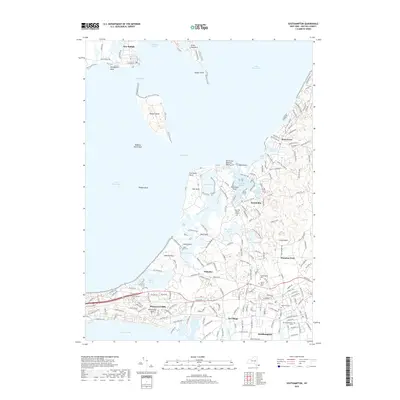
2019 Map of Southampton
USGS Topo · Published 2019About this map
Southampton and its surrounding coastal hamlets occupy this landscape where the Atlantic meets the complex waterways of the Peconic Bays. The map reveals a dense network of local history, from the historic core of Southampton to the artistic enclave of Art Village. Significant genealogical interest is found in the numerous burial sites, including the Old Southampton Cem, North End Cem, and the North Sea Burial Ground. These sites, along with the St Andrews Ch, anchor the long-settled neighborhoods of the East End.
Find a feature on this map
203 named features on this map. Tap any name to fly to it.
Don’t see what you’re looking for? This feature index may not catch every label — zoom into the map to look around manually.
Map Details
Editions of this 2019 Southampton Map
This is the sole edition of this map. No revisions or reprints were ever made.
Other maps of this area

1903 · Sag Harbor
USGS Topo · 1:62,500

1903 · Riverhead
USGS Topo · 1:62,500

1904 · Sag Harbor
USGS Topo · 1:62,500

1904 · Shelter Island
USGS Topo · 1:62,500

1904 · Riverhead
USGS Topo · 1:62,500

1943 · Riverhead
USGS Topo · 1:62,500

1946 · Sag Harbor
USGS Topo · 1:24,000

1947 · Mattituck
USGS Topo · 1:24,000

1947 · Mattituck Hills
USGS Topo · 1:24,000

1947 · Southold
USGS Topo · 1:24,000