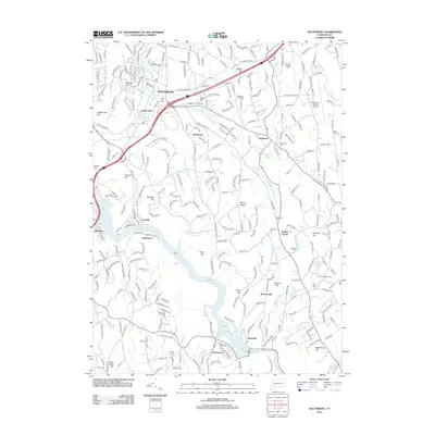
2012 Map of Southbury
USGS Topo · Published 2012About this map
The Pomperaug River valley and the expansive waters of Lake Zoar anchor this 2012 survey of New Haven County. The landscape is defined by its historic agricultural hamlets and distinct upland ridges, including Pine Hill, Georges Hill, and Mount Pisgah. Settlement patterns are concentrated around the traditional centers of Southbury and Quaker Farms, while the eastern portion of the map is dominated by the Waterbury-Oxford Airport and the sprawling industrial corridor near Southford.
Find a feature on this map
290 named features on this map. Tap any name to fly to it.
Don’t see what you’re looking for? This feature index may not catch every label — zoom into the map to look around manually.
Map Details
Editions of this 2012 Southbury Map
This is the sole edition of this map. No revisions or reprints were ever made.
Other maps of this area

1889 · Derby
USGS Topo · 1:62,500

1891 · Derby
USGS Topo · 1:62,500

1892 · Danbury
USGS Topo · 1:62,500

1892 · New Milford
USGS Topo · 1:62,500

1893 · Waterbury
USGS Topo · 1:62,500

1893 · New Milford
USGS Topo · 1:62,500

1893 · Derby
USGS Topo · 1:62,500

1904 · New Milford
USGS Topo · 1:62,500

1904 · Waterbury
USGS Topo · 1:62,500

1904 · Litchfield
USGS Topo · 1:125,000