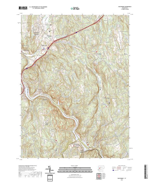
2024 Map of Southbury
USGS Topo · Published 2024About this map
The Housatonic River carves a deep valley through this corner of New Haven County, defining the boundary between established hillside settlements and modern infrastructure. To the north, the planned community of Heritage Village and the town of Southbury sit along the Pomperaug River corridor, where Interstate 84 now cuts through the landscape. The map reveals a high concentration of small family-named hills like Ichabod Hill and Bowers Hill, indicating the area's long-standing agricultural and residential partition. Further south, the river widens near Stevenson and East Village, while the eastern terrain transitions into the community of Quaker Farms. For genealogists, several burial grounds are documented, including Pine Hill Cem and Brookside Cem. The presence of the Waterbury-Oxford Airport on the eastern edge marks the continued evolution of transport in this historic river valley.
Find a feature on this map
61 named features on this map. Tap any name to fly to it.
Don’t see what you’re looking for? This feature index may not catch every label — zoom into the map to look around manually.
Map Details
Editions of this 2024 Southbury Map
This is the sole edition of this map. No revisions or reprints were ever made.
Other maps of this area

1889 · Derby
USGS Topo · 1:62,500

1891 · Derby
USGS Topo · 1:62,500

1892 · Danbury
USGS Topo · 1:62,500

1892 · New Milford
USGS Topo · 1:62,500

1893 · Waterbury
USGS Topo · 1:62,500

1893 · New Milford
USGS Topo · 1:62,500

1893 · Derby
USGS Topo · 1:62,500

1904 · New Milford
USGS Topo · 1:62,500

1904 · Waterbury
USGS Topo · 1:62,500

1904 · Litchfield
USGS Topo · 1:125,000