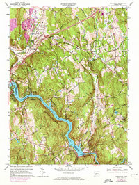
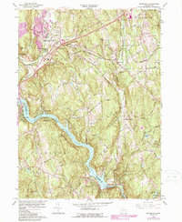
1964 Map of Southbury
USGS Topo · Published 1974About this map
Lake Zoar and the Housatonic River anchor this mid-century landscape where Fairfield and New Haven counties meet. The era's infrastructure is clearly visible, from the Stevenson Dam and its associated Powerplant at the southern bend to the Waterbury-Oxford Airport in the northeast. The village of Southbury shows its development along Bullet Hill Road, while smaller settlements like South Britain and Quaker Farms retain their historic clusters. Local history is preserved in the numerous burial grounds, including Pine Hill Cem and Middleground Cem, while the industrial past of the Little River is evidenced by Papermill Pond. Conservation land is already established at Kettletown State Park and Southford Falls State Park, marking the balance between the region's suburban growth and its protected woodlands.
Find a feature on this map
70 named features on this map. Tap any name to fly to it.
Don’t see what you’re looking for? This feature index may not catch every label — zoom into the map to look around manually.
Map Details
Editions of this 1964 Southbury Map
5 editions found
Other maps of this area

1889 · Derby
USGS Topo · 1:62,500

1891 · Derby
USGS Topo · 1:62,500

1892 · Danbury
USGS Topo · 1:62,500

1892 · New Milford
USGS Topo · 1:62,500

1893 · Waterbury
USGS Topo · 1:62,500

1893 · New Milford
USGS Topo · 1:62,500

1893 · Derby
USGS Topo · 1:62,500

1904 · New Milford
USGS Topo · 1:62,500

1904 · Waterbury
USGS Topo · 1:62,500

1904 · Litchfield
USGS Topo · 1:125,000