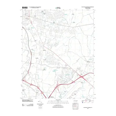
2010 Map of Southeast Durham
USGS Topo · Published 2010About this map
Raleigh-Durham Airport and the surrounding tech-corridor infrastructure define this 2010 landscape at the meeting point of Durham and Wake counties. The map captures a moment of intense suburban and industrial development, characterized by complex highway interchanges and the sprawling William Umstead State Park in the southeast. High-density residential patterns are visible near Bethesda and Oak Grove, while older crossroads like Lynn Crossroads and Nelson remain identifiable landmarks amidst the modern growth.
Find a feature on this map
94 named features on this map. Tap any name to fly to it.
Don’t see what you’re looking for? This feature index may not catch every label — zoom into the map to look around manually.
Map Details
Editions of this 2010 Southeast Durham Map
This is the sole edition of this map. No revisions or reprints were ever made.
Other maps of this area

1943 · Durham South
USGS Topo · 1:62,500

1943 · Raleigh
USGS Topo · 1:62,500

1943 · Creedmoor
USGS Topo · 1:62,500

1944 · Creedmoor
USGS Topo · 1:62,500

1951 · Raleigh
USGS Topo · 1:62,500

1951 · Durham South
USGS Topo · 1:62,500

1951 · Durham North
USGS Topo · 1:62,500

1953 · Raleigh
USGS Topo · 1:250,000

1953 · Greensboro
USGS Topo · 1:250,000

1954 · Greensboro
USGS Topo · 1:250,000