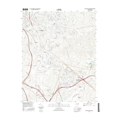
2016 Map of Southeast Durham
USGS Topo · Published 2016About this map
Raleigh-Durham International Airport dominates the southern portion of this landscape, positioned along the border of Durham Co and Wake Co. The surrounding geography reflects the rapid suburbanization and infrastructure development of the Research Triangle, with the city of Durham expanding southeast toward Raleigh. Significant residential and industrial nodes are visible at Bethesda, Nelson, and Oak Grove, while the Apex Sch of Theology and several cemeteries, including Restlawn Memorial Gardens, serve the growing community. A dense network of local roads and major thoroughfares like N Miami Blvd and Glenwood Ave connect these hubs. Despite the urban growth, numerous small lakes and ponds, such as Stonebridge Lake, Poole Lake, and Brier Cr Reservoir, provide localized drainage for tributaries like Lick Cr and Stirrup Iron Cr.
Find a feature on this map
238 named features on this map. Tap any name to fly to it.
Don’t see what you’re looking for? This feature index may not catch every label — zoom into the map to look around manually.
Map Details
Editions of this 2016 Southeast Durham Map
This is the sole edition of this map. No revisions or reprints were ever made.
Other maps of this area

1943 · Durham South
USGS Topo · 1:62,500

1943 · Raleigh
USGS Topo · 1:62,500

1943 · Creedmoor
USGS Topo · 1:62,500

1944 · Creedmoor
USGS Topo · 1:62,500

1951 · Raleigh
USGS Topo · 1:62,500

1951 · Durham South
USGS Topo · 1:62,500

1951 · Durham North
USGS Topo · 1:62,500

1953 · Raleigh
USGS Topo · 1:250,000

1953 · Greensboro
USGS Topo · 1:250,000

1954 · Greensboro
USGS Topo · 1:250,000