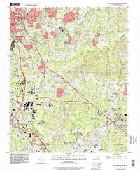
1993 Map of Southeast Durham
USGS Topo · Published 1998About this map
Research Triangle Park anchors the southwestern portion of this landscape, reflecting the late 20th-century development of this technological corridor between Durham and Raleigh. The map captures a mix of rapid suburban expansion and established rural communities such as Bethesda, Oak Grove, and Lynn Crossroads. Transportation and infrastructure are central to the area's identity, with the Raleigh-Durham Airport occupying significant space in the southeast, while the Durham Co Wake Co line bisects the region. Natural spaces and public lands provide a buffer to the growing urban centers, including the protected boundaries of the Falls Lake State Recreation Area and William B Umstead State Park. Cultural landmarks, from Southern High Sch to numerous local congregations like Andrews Chapel and Village Chapel, show the social fabric of these North Carolina communities during the 1990s.
Find a feature on this map
46 named features on this map. Tap any name to fly to it.
Don’t see what you’re looking for? This feature index may not catch every label — zoom into the map to look around manually.
Map Details
Editions of this 1993 Southeast Durham Map
This is the sole edition of this map. No revisions or reprints were ever made.
Other maps of this area

1943 · Durham South
USGS Topo · 1:62,500

1943 · Raleigh
USGS Topo · 1:62,500

1943 · Creedmoor
USGS Topo · 1:62,500

1944 · Creedmoor
USGS Topo · 1:62,500

1951 · Raleigh
USGS Topo · 1:62,500

1951 · Durham South
USGS Topo · 1:62,500

1951 · Durham North
USGS Topo · 1:62,500

1953 · Raleigh
USGS Topo · 1:250,000

1953 · Greensboro
USGS Topo · 1:250,000

1954 · Greensboro
USGS Topo · 1:250,000