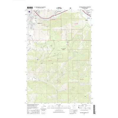
2017 Map of Southeast Missoula
USGS Topo · Published 2017About this map
The Univ of Montana campus serves as a central landmark where the valley floor meets the steep ascent of Mt Sentinel and Mt Jumbo. This landscape is defined by the confluence of major waterways, including Rattlesnake Creek and the Clark Fork, which flow toward the Milltown Reservoir near Milltown. The urban grid of Missoula is visible with its detailed street names, from S Higgins Ave to University Ave, while the southeastern portion of the map transitions into the protected highlands of the Lolo National Forest. Transportation corridors like the BNSF Railway and I-90 trace the river valleys, connecting the city to outlying communities like East Missoula and Bonner Junction. Significant local peaks such as Miller Peak and Mt Dean Stone anchor the southern reaches, overseeing numerous drainages like Pattee Cr and Miller Creek.
Find a feature on this map
103 named features on this map. Tap any name to fly to it.
Don’t see what you’re looking for? This feature index may not catch every label — zoom into the map to look around manually.
Map Details
Editions of this 2017 Southeast Missoula Map
This is the sole edition of this map. No revisions or reprints were ever made.
Other maps of this area

1903 · Bonner
USGS Topo · 1:125,000

1912 · Missoula
USGS Topo · 1:125,000

1947 · Butte
USGS Topo · 1:250,000

1956 · Hamilton
USGS Topo · 1:250,000

1958 · Butte
USGS Topo · 1:250,000

1959 · Hamilton
USGS Topo · 1:250,000

1959 · Cleveland Mountain
USGS Topo · 1:62,500

1960 · Butte
USGS Topo · 1:250,000

1960 · Hamilton
USGS Topo · 1:250,000

1962 · Butte
USGS Topo · 1:250,000