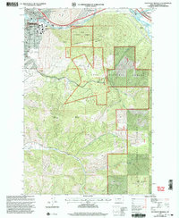
1999 Map of Southeast Missoula
USGS Topo · Published 2003About this map
The University of Montana campus and the eastern residential districts of Missoula anchor this late-twentieth-century landscape, where the urban grid gives way to the steep climbs of Mount Sentinel and Mount Jumbo. The Clark Fork winds through the prominent Hellgate Canyon, serving as a primary corridor for transportation and industry. To the east, the industrial character of the era is evident at Milltown, site of the Milltown Dam and its reservoir, Tunnel Lake.
Find a feature on this map
49 named features on this map. Tap any name to fly to it.
Don’t see what you’re looking for? This feature index may not catch every label — zoom into the map to look around manually.
Map Details
Editions of this 1999 Southeast Missoula Map
This is the sole edition of this map. No revisions or reprints were ever made.
Other maps of this area

1903 · Bonner
USGS Topo · 1:125,000

1912 · Missoula
USGS Topo · 1:125,000

1947 · Butte
USGS Topo · 1:250,000

1956 · Hamilton
USGS Topo · 1:250,000

1958 · Butte
USGS Topo · 1:250,000

1959 · Hamilton
USGS Topo · 1:250,000

1959 · Cleveland Mountain
USGS Topo · 1:62,500

1960 · Butte
USGS Topo · 1:250,000

1960 · Hamilton
USGS Topo · 1:250,000

1962 · Butte
USGS Topo · 1:250,000