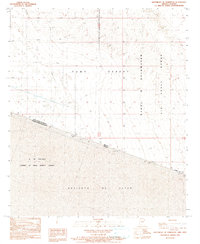
1990 Map of Southeast of Somerton
USGS Topo · Published 1991About this map
The international border between the United States of America and Mexico bisects this arid landscape, creating a stark visual divide between the Yuma Desert of Arizona and the Desierto de Altar in Sonora. To the north, the terrain is dominated by the western reaches of the Barry M Goldwater Air Force Range, marked by a network of 4wd tracks and infrastructure like a Substation and Borrow Pit.
Find a feature on this map
19 named features on this map. Tap any name to fly to it.
Don’t see what you’re looking for? This feature index may not catch every label — zoom into the map to look around manually.
Map Details
Editions of this 1990 Southeast of Somerton Map
This is the sole edition of this map. No revisions or reprints were ever made.
Other maps of this area

1903 · Yuma
USGS Topo · 1:125,000

1905 · Yuma
USGS Topo · 1:125,000

1926 · Fortuna
USGS Topo · 1:62,500

1929 · Fortuna
USGS Topo · 1:62,500

1940 · Yuma
USGS Topo · 1:62,500

1942 · Yuma
USGS Topo · 1:250,000

1945 · Yuma
USGS Topo · 1:62,500

1954 · El Centro
USGS Topo · 1:250,000

1955 · El Centro
USGS Topo · 1:250,000

1958 · El Centro
USGS Topo · 1:250,000