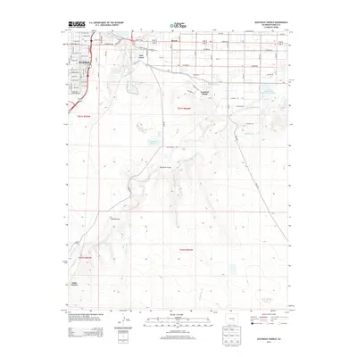
2013 Map of Southeast Pueblo
USGS Topo · Published 2013About this map
The industrial and residential edges of Pueblo meet the high plains landscape in this early 21st-century survey. The map details the grid-like expansion of neighborhoods south of the city core, including Salt Creek and Lombard Village, while maintaining clear records of established community landmarks like Roselawn Cem. Water management remains central to the region's character, evidenced by the intricate path of the Bessemer Ditch and large-scale water storage at Comanche Reservoir and the Saint Charles Mesa Reservoir Number 2. The landscape is defined by the winding course of the Saint Charles River and its various drainages, such as Thomkins Arroyo and Edson Arroyo, which carve through the terrain south of the Blende community. Further south, the map identifies the small settlements of Saint Charles and Lime, providing a precise look at the transition from urban density to rural reaches.
Find a feature on this map
78 named features on this map. Tap any name to fly to it.
Don’t see what you’re looking for? This feature index may not catch every label — zoom into the map to look around manually.
Map Details
Editions of this 2013 Southeast Pueblo Map
This is the sole edition of this map. No revisions or reprints were ever made.
Other maps of this area

1891 · Pueblo
USGS Topo · 1:125,000

1891 · Nepesta
USGS Topo · 1:125,000

1893 · Nepesta
USGS Topo · 1:125,000

1894 · Pueblo
USGS Topo · 1:125,000

1896 · Pueblo
USGS Topo · 1:125,000

1897 · Pueblo
USGS Topo · 1:125,000

1904 · Nepesta
USGS Topo · 1:125,000

1954 · Pueblo
USGS Topo · 1:250,000

1957 · Pueblo
USGS Topo · 1:250,000

1958 · Pueblo
USGS Topo · 1:250,000