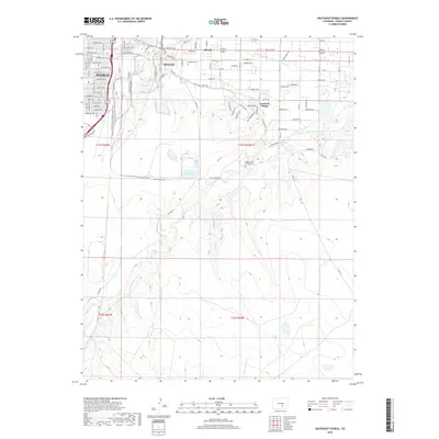
2019 Map of Southeast Pueblo
USGS Topo · Published 2019About this map
Pueblo expands southeastward across a landscape defined by industrial water management and historic burial grounds. The agricultural and utility history of the region is evident in the path of the Bessemer Ditch and the Tucker Ditch, which parallel the Saint Charles River as it winds toward the plains. Significant local landmarks include Roselawn Cem and the Wiggins Saint Charles Cem, which serve as vital touchstones for genealogical research in the communities of Salt Creek, Blende, and Lombard Village.
Find a feature on this map
66 named features on this map. Tap any name to fly to it.
Don’t see what you’re looking for? This feature index may not catch every label — zoom into the map to look around manually.
Map Details
Editions of this 2019 Southeast Pueblo Map
This is the sole edition of this map. No revisions or reprints were ever made.
Other maps of this area

1891 · Pueblo
USGS Topo · 1:125,000

1891 · Nepesta
USGS Topo · 1:125,000

1893 · Nepesta
USGS Topo · 1:125,000

1894 · Pueblo
USGS Topo · 1:125,000

1896 · Pueblo
USGS Topo · 1:125,000

1897 · Pueblo
USGS Topo · 1:125,000

1904 · Nepesta
USGS Topo · 1:125,000

1954 · Pueblo
USGS Topo · 1:250,000

1957 · Pueblo
USGS Topo · 1:250,000

1958 · Pueblo
USGS Topo · 1:250,000