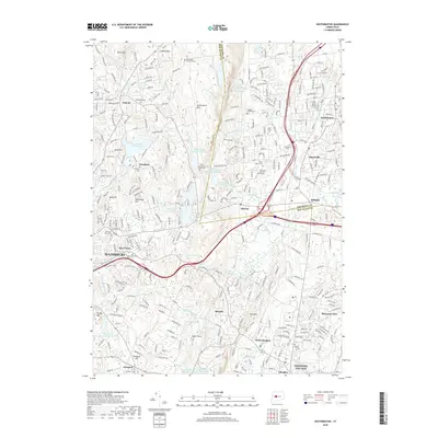
2018 Map of Southington
USGS Topo · Published 2018About this map
Southington Mtn dominates the central geography of this region, separating the industrial and residential developments of Plantsville and Milldale from the suburban stretches of Wolcott to the west. The landscape is defined by its transition from the valley floor of the Quinnipiac River to higher elevations such as Peck Mtn and Bluff Head. This 2018 survey reveals a high density of historical burial sites, including the Merriman Burying Ground and Northeast Burial Ground, which provide valuable touchpoints for genealogical research in Hartford and New Haven counties. Significant water management is evident through the series of reservoirs, notably Scoville Reservoir and the Southington Reservoir Number 2, which are integrated into the varied terrain of hills like Tame Buck Hill and Lindsley Hill.
Find a feature on this map
81 named features on this map. Tap any name to fly to it.
Don’t see what you’re looking for? This feature index may not catch every label — zoom into the map to look around manually.
Map Details
Editions of this 2018 Southington Map
This is the sole edition of this map. No revisions or reprints were ever made.
Other maps of this area

1889 · Derby
USGS Topo · 1:62,500

1891 · Derby
USGS Topo · 1:62,500

1892 · New Haven
USGS Topo · 1:62,500

1892 · Meriden
USGS Topo · 1:62,500

1893 · Waterbury
USGS Topo · 1:62,500

1893 · Meriden
USGS Topo · 1:62,500

1893 · Derby
USGS Topo · 1:62,500

1904 · Waterbury
USGS Topo · 1:62,500

1904 · Litchfield
USGS Topo · 1:125,000

1906 · Farmington
USGS Topo · 1:125,000