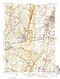
1946 Map of Southington
USGS Topo · Published 1946About this map
Southington Mountain stands as a central topographic divide in this mid-1940s landscape, separating the industrial and residential growth of Southington from the reservoirs and rugged terrain of Wolcott. The eastern valley is defined by the New York New Haven and Hartford railroad corridor, which links the manufacturing centers of Plantsville, Milldale, and Marion. To the west, the economy appears more centered on water management and rural life, evidenced by the clustered Southington Reservoir No. 1, No. 2, and No. 3, alongside several historic cemeteries including the Northeast Burying Ground. South of the Hartford and New Haven County line, the State Reformatory and the village of Cheshire mark the lower reaches of the map, where the Quinnipiac River and Tenmile River drainage systems shape the local geography.
Find a feature on this map
57 named features on this map. Tap any name to fly to it.
Don’t see what you’re looking for? This feature index may not catch every label — zoom into the map to look around manually.
Map Details
Editions of this 1946 Southington Map
This is the sole edition of this map. No revisions or reprints were ever made.
Other maps of this area

1889 · Derby
USGS Topo · 1:62,500

1891 · Derby
USGS Topo · 1:62,500

1892 · New Haven
USGS Topo · 1:62,500

1892 · Meriden
USGS Topo · 1:62,500

1893 · Waterbury
USGS Topo · 1:62,500

1893 · Meriden
USGS Topo · 1:62,500

1893 · Derby
USGS Topo · 1:62,500

1904 · Waterbury
USGS Topo · 1:62,500

1904 · Litchfield
USGS Topo · 1:125,000

1906 · Farmington
USGS Topo · 1:125,000