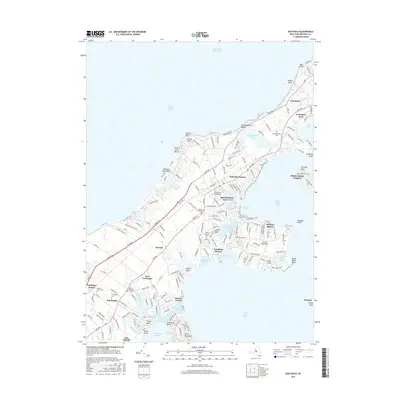
2016 Map of Southold
USGS Topo · Published 2016About this map
Southold and the surrounding maritime landscape of the North Fork reflect a deeply rooted coastal heritage where narrow necks of land reach into Little Peconic Bay and Shelter Island Sound. This modern survey reveals a dense network of local history, marked by historic burial sites such as the Old Burying Ground and numerous community graveyards like Arshamomaque Cem and Willow Hill Cem. The geography is defined by its intricate shoreline, where Goldsmith Inlet and Town Creek create natural harbors for centuries-old settlements.
Find a feature on this map
182 named features on this map. Tap any name to fly to it.
Don’t see what you’re looking for? This feature index may not catch every label — zoom into the map to look around manually.
Map Details
Editions of this 2016 Southold Map
This is the sole edition of this map. No revisions or reprints were ever made.
Other maps of this area

1903 · Sag Harbor
USGS Topo · 1:62,500

1903 · Riverhead
USGS Topo · 1:62,500

1904 · Sag Harbor
USGS Topo · 1:62,500

1904 · Shelter Island
USGS Topo · 1:62,500

1904 · Riverhead
USGS Topo · 1:62,500

1943 · Riverhead
USGS Topo · 1:62,500

1946 · Sag Harbor
USGS Topo · 1:24,000
1947 · Orient
USGS Topo · 1:24,000

1947 · Mattituck
USGS Topo · 1:24,000

1947 · Mattituck Hills
USGS Topo · 1:24,000