
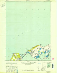
1947 Map of Southold
USGS Topo · Published 1947About this map
Southold and the surrounding North Fork villages are captured here in the mid-1940s, revealing a landscape defined by its deep maritime and agricultural roots. The Long Island railroad cuts through the heart of the peninsula, serving established hubs like Cutchogue and Peconic, while the coastline is dotted with historical navigational aids and community landmarks. Of particular note is the Horton Pt Lighthouse standing watch over the Sound, and the commemorative Founders Ldg on the shores of Southold Bay. The map illustrates a period of residential expansion along the waterfront, with developments like Reydon Shores and Laughing Waters emerging near the established Golf Club. This survey provides a precise look at the intricate network of tidal inlets, such as Jockey Creek and Corey Creek, that have long dictated the layout of roads and settlements in this part of Suffolk County.
Find a feature on this map
58 named features on this map. Tap any name to fly to it.
Don’t see what you’re looking for? This feature index may not catch every label — zoom into the map to look around manually.
Map Details
Editions of this 1947 Southold Map
This is the sole edition of this map. No revisions or reprints were ever made.
Other maps of this area

1903 · Sag Harbor
USGS Topo · 1:62,500

1903 · Riverhead
USGS Topo · 1:62,500

1904 · Sag Harbor
USGS Topo · 1:62,500

1904 · Shelter Island
USGS Topo · 1:62,500

1904 · Riverhead
USGS Topo · 1:62,500

1943 · Riverhead
USGS Topo · 1:62,500

1946 · Sag Harbor
USGS Topo · 1:24,000
1947 · Orient
USGS Topo · 1:24,000

1947 · Mattituck
USGS Topo · 1:24,000

1947 · Mattituck Hills
USGS Topo · 1:24,000