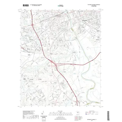
2020 Map of Southwest Columbia
USGS Topo · Published 2020About this map
The Congaree River serves as the central artery for this South Carolina landscape, separating Columbia and Olympia on the eastern bank from West Columbia and Cayce to the west. This 2020 survey illustrates the dense urban and academic infrastructure of the University of South Carolina in the northeast, contrasted with the industrial and transit-focused corridors of Lexington County. The southern portion of the map reveals a more dispersed settlement pattern, where small communities like Dixiana, Kinsler, and Pine Ridge are interspersed among the wetlands of Hogobook Swamp and the drainage of Congaree Creek. Aviation history and utility are prominent features, with the sprawling Columbia Metropolitan Airport dominating the western terrain while the Jim Hamilton L B Owens Airport occupies the river plain to the east. Local history is preserved in numerous family and community burial grounds, including Pisgah Cem and Saint Johns Cem.
Find a feature on this map
77 named features on this map. Tap any name to fly to it.
Don’t see what you’re looking for? This feature index may not catch every label — zoom into the map to look around manually.
Map Details
Editions of this 2020 Southwest Columbia Map
This is the sole edition of this map. No revisions or reprints were ever made.
Other maps of this area

1904 · Columbia
USGS Topo · 1:125,000

1935 · Killian
USGS Topo · 1:48,000

1937 · Killian
USGS Topo · 1:62,500

1941 · Spartanburg
USGS Topo · 1:250,000

1942 · Camden
USGS Topo · 1:125,000

1944 · Edmund
USGS Topo · 1:62,500

1946 · Irmo
USGS Topo · 1:24,000

1947 · Columbia North
USGS Topo · 1:24,000

1948 · Hopkins
USGS Topo · 1:62,500

1948 · Irmo
USGS Topo · 1:24,000