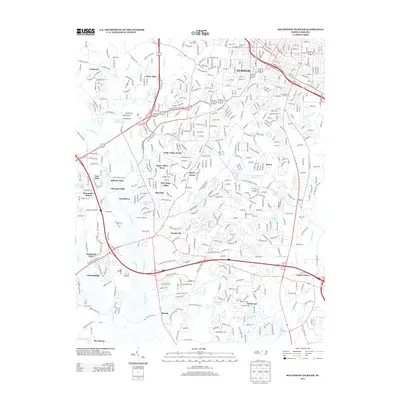
2013 Map of Southwest Durham
USGS Topo · Published 2013About this map
The southwest quadrant of Durham is defined by a dense network of suburban expansion and natural drainage systems just prior to the mid-2010s. The landscape is characterized by established residential enclaves such as Hope Valley North, Colony Park, and Woodcroft, which are woven between the riparian corridors of New Hope Cr and Third Fork Cr. This 2013 survey illustrates the modern transition of the area from older rural outposts like Blands and Lowes Grove into a contiguous urban corridor. Several small water bodies, including Matthews Lake and Straford Lake Number Two, serve as focal points for local development. The transportation infrastructure is anchored by major thoroughfares like Pickett RD and W Cornwallis RD, while the NS railroad line cuts through the northeast, connecting the city center to the surrounding industrial landscape.
Find a feature on this map
169 named features on this map. Tap any name to fly to it.
Don’t see what you’re looking for? This feature index may not catch every label — zoom into the map to look around manually.
Map Details
Editions of this 2013 Southwest Durham Map
This is the sole edition of this map. No revisions or reprints were ever made.
Other maps of this area

1943 · Durham South
USGS Topo · 1:62,500

1946 · Chapel Hill
USGS Topo · 1:24,000

1947 · Chapel Hill
USGS Topo · 1:31,680

1951 · Farrington
USGS Topo · 1:24,000

1951 · Durham South
USGS Topo · 1:62,500

1951 · Durham North
USGS Topo · 1:62,500

1953 · Raleigh
USGS Topo · 1:250,000

1953 · Greensboro
USGS Topo · 1:250,000

1954 · Greensboro
USGS Topo · 1:250,000

1954 · Raleigh
USGS Topo · 1:250,000