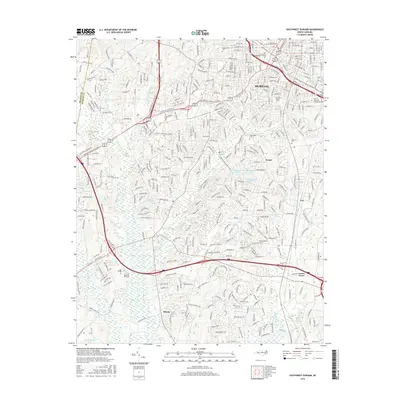
2016 Map of Southwest Durham
USGS Topo · Published 2016About this map
Durham serves as the focal point of this 2016 survey, which documents the dense suburban and institutional growth of the Research Triangle region. The map captures the extensive footprints of higher education, including N Carolina Central Univ and Durham Technical Community Coll, alongside the Art Institute of Raleigh-Durham. Residential expansion is visible through established and newer communities like Keene, Few, and Lowes Grove, while local history is anchored by large traditional burial grounds such as Maplewood Cem and Beechwood Cem. The landscape is characterized by a network of drainage basins, with Third Fork Cr and Northeast Cr winding through the terrain. Numerous small water bodies like Matthews Lake and Parkwood Lake are integrated into the neighborhood developments that have transformed the area from its earlier rural character.
Find a feature on this map
53 named features on this map. Tap any name to fly to it.
Don’t see what you’re looking for? This feature index may not catch every label — zoom into the map to look around manually.
Map Details
Editions of this 2016 Southwest Durham Map
This is the sole edition of this map. No revisions or reprints were ever made.
Other maps of this area

1943 · Durham South
USGS Topo · 1:62,500

1946 · Chapel Hill
USGS Topo · 1:24,000

1947 · Chapel Hill
USGS Topo · 1:31,680

1951 · Farrington
USGS Topo · 1:24,000

1951 · Durham South
USGS Topo · 1:62,500

1951 · Durham North
USGS Topo · 1:62,500

1953 · Raleigh
USGS Topo · 1:250,000

1953 · Greensboro
USGS Topo · 1:250,000

1954 · Greensboro
USGS Topo · 1:250,000

1954 · Raleigh
USGS Topo · 1:250,000