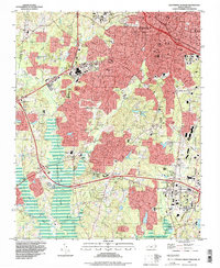
1993 Map of Southwest Durham
USGS Topo · Published 1998About this map
Duke University and North Carolina Central University anchor the academic landscape of this region during a period of significant suburban expansion south of the Durham city center. The transition from urban density to rural terrain is visible as one moves toward Keene and Blands, where the topography begins to meet the shores of B Everett Jordan Lake. The map details a dense network of educational institutions, from historic local sites like the Lyon Park Sch to the expanding campus of Durham College, reflecting the area's mid-century growth as a regional hub for education and research near the Triangle Parkway.
Find a feature on this map
60 named features on this map. Tap any name to fly to it.
Don’t see what you’re looking for? This feature index may not catch every label — zoom into the map to look around manually.
Map Details
Editions of this 1993 Southwest Durham Map
This is the sole edition of this map. No revisions or reprints were ever made.
Other maps of this area

1943 · Durham South
USGS Topo · 1:62,500

1946 · Chapel Hill
USGS Topo · 1:24,000

1947 · Chapel Hill
USGS Topo · 1:31,680

1951 · Farrington
USGS Topo · 1:24,000

1951 · Durham South
USGS Topo · 1:62,500

1951 · Durham North
USGS Topo · 1:62,500

1953 · Raleigh
USGS Topo · 1:250,000

1953 · Greensboro
USGS Topo · 1:250,000

1954 · Greensboro
USGS Topo · 1:250,000

1954 · Raleigh
USGS Topo · 1:250,000