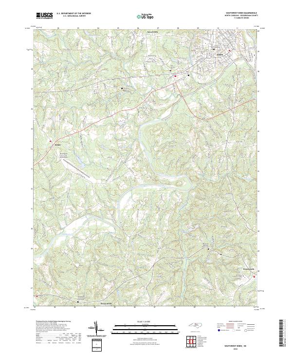
2022 Map of Southwest Eden
USGS Topo · Published 2022About this map
The Dan River meanders through the heart of Rockingham County, carving a path between the northern industrial anchor of Eden and the southern seat of Wentworth. This landscape is defined by its deep genealogical roots, visible in the numerous burial grounds and rural congregations that dot the countryside, such as the Providence Baptist Church Cem and the Wentworth Methodist Church Cem. The terrain south of Sunset Hills transitions from the structured residential street grids of Eden to the broader agricultural and wooded tracts surrounding Pleasantville.
Find a feature on this map
170 named features on this map. Tap any name to fly to it.
Don’t see what you’re looking for? This feature index may not catch every label — zoom into the map to look around manually.
Map Details
Editions of this 2022 Southwest Eden Map
This is the sole edition of this map. No revisions or reprints were ever made.
Other maps of this area

1924 · Martinsville
USGS Topo · 1:48,000

1924 · Draper
USGS Topo · 1:48,000

1926 · Martinsville
USGS Topo · 1:62,500

1926 · Draper
USGS Topo · 1:62,500

1927 · Martinsville
USGS Topo · 1:62,500

1944 · Martinsville
USGS Topo · 1:62,500

1944 · Draper
USGS Topo · 1:62,500

1953 · Greensboro
USGS Topo · 1:250,000

1954 · Greensboro
USGS Topo · 1:250,000

1962 · Greensboro
USGS Topo · 1:250,000