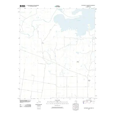
2010 Map of Southwest Lake Kemp
USGS Topo · Published 2010About this map
Lake Kemp dominates the northern expanse of this Baylor County landscape, where the waters of the Wichita River are impounded within a complex shoreline of inlets and points. The terrain south of the reservoir is defined by a dense network of seasonal drainages, including Hog Creek and Brushy Creek, which carve through the plains toward the river valley. To the southeast, the distinct elevation of Tabletop Mountain rises above the surrounding flats, serving as a prominent landmark for the region.
Find a feature on this map
31 named features on this map. Tap any name to fly to it.
Don’t see what you’re looking for? This feature index may not catch every label — zoom into the map to look around manually.
Map Details
Editions of this 2010 Southwest Lake Kemp Map
This is the sole edition of this map. No revisions or reprints were ever made.
Other maps of this area

1954 · Wichita Falls
USGS Topo · 1:250,000

1958 · Wichita Falls
USGS Topo · 1:250,000

1966 · Seymour West
USGS Topo · 1:24,000

1966 · Santa Rosa Lake SW
USGS Topo · 1:24,000

1966 · Soap Creek
USGS Topo · 1:24,000

1966 · Northeast Lake Kemp
USGS Topo · 1:24,000

1966 · Southeast Lake Kemp
USGS Topo · 1:24,000

1966 · Bomarton
USGS Topo · 1:24,000

1966 · Northwest Lake Kemp
USGS Topo · 1:24,000

1966 · Southwest Lake Kemp
USGS Topo · 1:24,000