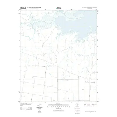
2013 Map of Southwest Lake Kemp
USGS Topo · Published 2013About this map
Lake Kemp dominates the northern reaches of this Baylor County landscape, where the Wichita River feeds into its sprawling reservoir system. The terrain transitions from the aqueous margins of Lost Lake and Fish Creek into a network of rugged drainages and ranching country. The map reveals a pastoral pattern of land use, centered around specific operational hubs like Jones Cow Camp and the prominent landmark of Tabletop Mtn.
Find a feature on this map
31 named features on this map. Tap any name to fly to it.
Don’t see what you’re looking for? This feature index may not catch every label — zoom into the map to look around manually.
Map Details
Editions of this 2013 Southwest Lake Kemp Map
This is the sole edition of this map. No revisions or reprints were ever made.
Other maps of this area

1954 · Wichita Falls
USGS Topo · 1:250,000

1958 · Wichita Falls
USGS Topo · 1:250,000

1966 · Seymour West
USGS Topo · 1:24,000

1966 · Santa Rosa Lake SW
USGS Topo · 1:24,000

1966 · Soap Creek
USGS Topo · 1:24,000

1966 · Northeast Lake Kemp
USGS Topo · 1:24,000

1966 · Southeast Lake Kemp
USGS Topo · 1:24,000

1966 · Bomarton
USGS Topo · 1:24,000

1966 · Northwest Lake Kemp
USGS Topo · 1:24,000

1966 · Southwest Lake Kemp
USGS Topo · 1:24,000