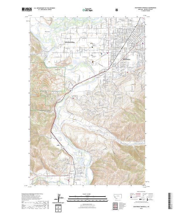
2024 Map of Southwest Missoula
USGS Topo · Published 2024About this map
The Bitterroot River carves a central path through this landscape, defining the boundaries between the suburban expansion of Missoula and the protected slopes of the Lolo National Forest. This modern survey illustrates the transition from the densely gridded streets of Orchard Homes and South Hills to the managed timberlands and drainages of the west. A significant historical and civic corridor is visible along Fort Missoula Rd, where both the Western Montana Veterans Cem and the Fort Missoula Post Cem are located, preserving a record of military presence in the valley. In the southern portion of the sheet, the community of Lolo sits near the confluence of several mountain drainages, including Worden Creek and Miller Creek. Local water management is evidenced by the Big Flat Ditch, which skirts the base of the forest, while river features like Kelly Island and Plummers Slough highlight the shifting nature of the river valley.
Find a feature on this map
155 named features on this map. Tap any name to fly to it.
Don’t see what you’re looking for? This feature index may not catch every label — zoom into the map to look around manually.
Map Details
Editions of this 2024 Southwest Missoula Map
This is the sole edition of this map. No revisions or reprints were ever made.
Other maps of this area

1903 · Bonner
USGS Topo · 1:125,000

1912 · Missoula
USGS Topo · 1:125,000

1947 · Butte
USGS Topo · 1:250,000

1956 · Hamilton
USGS Topo · 1:250,000

1958 · Butte
USGS Topo · 1:250,000

1959 · Hamilton
USGS Topo · 1:250,000

1959 · Cleveland Mountain
USGS Topo · 1:62,500

1960 · Butte
USGS Topo · 1:250,000

1960 · Hamilton
USGS Topo · 1:250,000

1962 · Butte
USGS Topo · 1:250,000