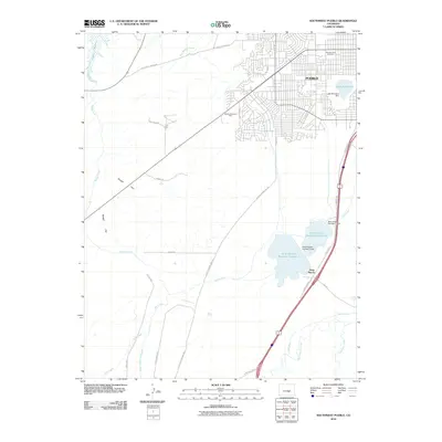
2010 Map of Southwest Pueblo
USGS Topo · Published 2010About this map
The city of Pueblo expands southward into the high desert landscape of Southern Colorado, where intricate water management systems define the terrain. Subdivisions and residential streets like Aster St and Lariat Rd push against the margins of managed water bodies such as Lake Minnequa and the Saint Charles Reservoir Number 3. The reliance on irrigation in this arid region is visible through the extensive network of engineered waterways, including the Minnequa Canal, Tucker Ditch, and the Saint Charles Flood Ditch. These features illustrate the transformation of the natural landscape into a structured urban and industrial environment.
Find a feature on this map
34 named features on this map. Tap any name to fly to it.
Don’t see what you’re looking for? This feature index may not catch every label — zoom into the map to look around manually.
Map Details
Editions of this 2010 Southwest Pueblo Map
This is the sole edition of this map. No revisions or reprints were ever made.
Other maps of this area

1891 · Pueblo
USGS Topo · 1:125,000

1894 · Pueblo
USGS Topo · 1:125,000

1896 · Pueblo
USGS Topo · 1:125,000

1897 · Pueblo
USGS Topo · 1:125,000

1954 · Pueblo
USGS Topo · 1:250,000

1957 · Pueblo
USGS Topo · 1:250,000

1958 · Pueblo
USGS Topo · 1:250,000

1960 · Southeast Pueblo
USGS Topo · 1:24,000

1961 · Northwest Pueblo
USGS Topo · 1:24,000

1961 · Southwest Pueblo
USGS Topo · 1:24,000