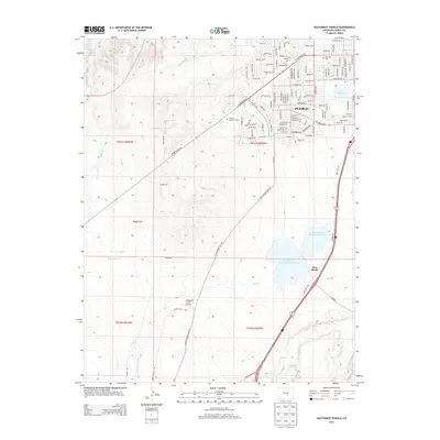
2013 Map of Southwest Pueblo
USGS Topo · Published 2013About this map
Pueblo expands southwestward in this survey, showcasing the transition from dense residential grids to the open terrain of Boggs Flat. The industrial and agricultural heritage of the region is evident in the water management infrastructure, including the Minnequa Canal, Tucker Ditch, and the Saint Charles Flood Ditch. These man-made channels support the area's development alongside natural watercourses like the Saint Charles River and Salt Creek. To the east, the landscape is defined by significant water storage at Saint Charles Reservoir Number 2 and Saint Charles Reservoir Number 3, situated near the small settlement of Stem Beach. Local landmarks such as Mtn View Cemetery, Valhalla Memorial Park, and Simonson Field Airport provide specific points of interest for genealogists and local historians tracking the modern footprint of the city against the high plains landscape.
Find a feature on this map
37 named features on this map. Tap any name to fly to it.
Don’t see what you’re looking for? This feature index may not catch every label — zoom into the map to look around manually.
Map Details
Editions of this 2013 Southwest Pueblo Map
This is the sole edition of this map. No revisions or reprints were ever made.
Other maps of this area

1891 · Pueblo
USGS Topo · 1:125,000

1894 · Pueblo
USGS Topo · 1:125,000

1896 · Pueblo
USGS Topo · 1:125,000

1897 · Pueblo
USGS Topo · 1:125,000

1954 · Pueblo
USGS Topo · 1:250,000

1957 · Pueblo
USGS Topo · 1:250,000

1958 · Pueblo
USGS Topo · 1:250,000

1960 · Southeast Pueblo
USGS Topo · 1:24,000

1961 · Northwest Pueblo
USGS Topo · 1:24,000

1961 · Southwest Pueblo
USGS Topo · 1:24,000