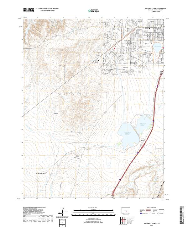
2022 Map of Southwest Pueblo
USGS Topo · Published 2022About this map
Pueblo expands southward into a landscape defined by industrial water management and arid plains in this 2022 survey. The urban grid gives way to the open reaches of Boggs Flat, where the complex irrigation and drainage network of the Minnequa Canal, Saint Charles Flood Ditch, and Tucker Ditch indicates the region's historical reliance on engineered water systems. To the east, the Saint Charles River and Salt Cr feed into significant infrastructure including Saint Charles Reservoir Number 2 and Saint Charles Reservoir Number 3. Cultural landmarks like Mountain View Cem and the Imperial Memorial Gardens border the residential outskirts, while Stem Beach stands as a distinct node along the southern transportation corridor. This map documents the intersection of modern suburban growth and the enduring agricultural and industrial waterworks of Pueblo County.
Find a feature on this map
37 named features on this map. Tap any name to fly to it.
Don’t see what you’re looking for? This feature index may not catch every label — zoom into the map to look around manually.
Map Details
Editions of this 2022 Southwest Pueblo Map
This is the sole edition of this map. No revisions or reprints were ever made.
Other maps of this area

1891 · Pueblo
USGS Topo · 1:125,000

1894 · Pueblo
USGS Topo · 1:125,000

1896 · Pueblo
USGS Topo · 1:125,000

1897 · Pueblo
USGS Topo · 1:125,000

1954 · Pueblo
USGS Topo · 1:250,000

1957 · Pueblo
USGS Topo · 1:250,000

1958 · Pueblo
USGS Topo · 1:250,000

1960 · Southeast Pueblo
USGS Topo · 1:24,000

1961 · Northwest Pueblo
USGS Topo · 1:24,000

1961 · Southwest Pueblo
USGS Topo · 1:24,000