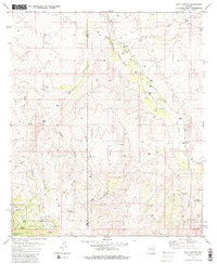
1981 Map of Soza Canyon
USGS Topo · Published 1981About this map
The San Pedro River corridor defines this arid landscape where the Pima and Cochise county line intersects the Coronado National Forest. By the early 1980s, the area remained characterized by isolated cattle operations and small rural hubs like Cascabel, where the ephemeral nature of settlement is evidenced by the Cascabel School (Site) and the Corral Gibson Ranch (Site). Ranching life is documented through named outposts such as Spear Ranch and Bar LY Ranch, alongside basic infrastructure including several wells and a cemetery. The topography transitions from the high peaks of the Rincon Mountains and the Little Rincon Mts into complex drainage systems like Soza Canyon and Canada Atravesada. Geological interests are marked by several mines and prospects scattered across the Mineta Ridge and Banco Ridge, reflecting a long history of mineral exploration in the desert foothills.
Find a feature on this map
42 named features on this map. Tap any name to fly to it.
Don’t see what you’re looking for? This feature index may not catch every label — zoom into the map to look around manually.
Map Details
Editions of this 1981 Soza Canyon Map
2 editions found
Other maps of this area

1904 · Tucson
USGS Topo · 1:125,000

1905 · Tucson
USGS Topo · 1:125,000

1945 · Redington
USGS Topo · 1:62,500

1945 · Happy Valley
USGS Topo · 1:62,500

1956 · Tucson
USGS Topo · 1:250,000

1957 · Bellota Ranch
USGS Topo · 1:62,500

1957 · Rincon Valley
USGS Topo · 1:62,500

1957 · Redington
USGS Topo · 1:62,500

1958 · Tucson
USGS Topo · 1:250,000

1958 · Happy Valley
USGS Topo · 1:62,500