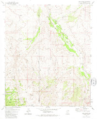
1981 Map of Soza Canyon
USGS Topo · Published 1981About this map
The San Pedro River valley defines this landscape on the boundary of Pima and Cochise counties, where riparian life contrasts with the arid uplands of the Rincon Mountains. The small community of Cascabel serves as the primary point of settlement, characterized by a series of family-held properties such as the Spear Ranch, Cascabel Ranch, and Bar LY Ranch. The presence of a Cascabel School (Site) and a Gleeson Ranch (Site) suggests the shifting nature of rural life in the high desert, while a Cem and scattered Ruins provide tangible links to early homesteaders and ranchers.
Find a feature on this map
40 named features on this map. Tap any name to fly to it.
Don’t see what you’re looking for? This feature index may not catch every label — zoom into the map to look around manually.
Map Details
Editions of this 1981 Soza Canyon Map
2 editions found
Other maps of this area

1904 · Tucson
USGS Topo · 1:125,000

1905 · Tucson
USGS Topo · 1:125,000

1945 · Redington
USGS Topo · 1:62,500

1945 · Happy Valley
USGS Topo · 1:62,500

1956 · Tucson
USGS Topo · 1:250,000

1957 · Bellota Ranch
USGS Topo · 1:62,500

1957 · Rincon Valley
USGS Topo · 1:62,500

1957 · Redington
USGS Topo · 1:62,500

1958 · Tucson
USGS Topo · 1:250,000

1958 · Happy Valley
USGS Topo · 1:62,500