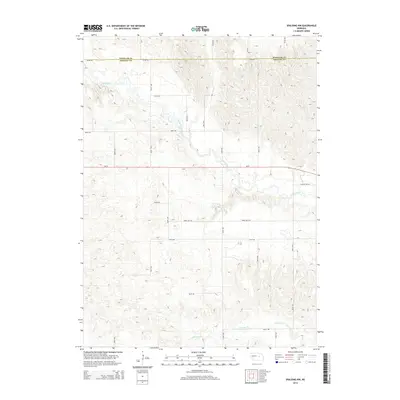
2014 Map of Spalding NW
USGS Topo · Published 2014About this map
The Cedar River meanders across this rural landscape at the junction of Wheeler Co and Greeley Co, cutting a distinct path through the Nebraska sandhills. The map illustrates a strictly organized section-line road network, where routes like Three Mile Rd and 817th Rd traverse the undulating terrain. A significant geographic transition is visible where the riparian corridor of the river breaks the geometric regularity of the surrounding plains. In the southern portion of the sheet, Freeman Cr drains into the larger river system, providing a secondary water source for the isolated farmsteads connected by Ne-91. This 2014 survey documents the persistence of the area's agricultural layout and its reliance on these natural watercourses for land division and local navigation, including more modern access points like College Inn Rd.
Find a feature on this map
20 named features on this map. Tap any name to fly to it.
Don’t see what you’re looking for? This feature index may not catch every label — zoom into the map to look around manually.
Map Details
Editions of this 2014 Spalding NW Map
This is the sole edition of this map. No revisions or reprints were ever made.
Other maps of this area

1954 · Greeley NE
USGS Topo · 1:24,000

1954 · Greeley
USGS Topo · 1:24,000

1954 · Spalding
USGS Topo · 1:24,000

1954 · Spalding SW
USGS Topo · 1:24,000

1954 · Spalding NW
USGS Topo · 1:24,000

1954 · Bartlett SE
USGS Topo · 1:24,000

1954 · Spalding SE
USGS Topo · 1:24,000

1955 · Broken Bow
USGS Topo · 1:250,000

1956 · Broken Bow
USGS Topo · 1:250,000

1960 · Spalding 2 SW
USGS Topo · 1:24,000