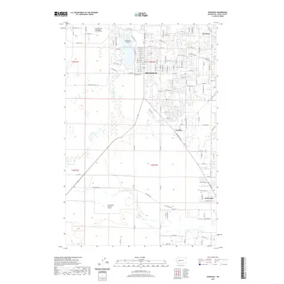
2020 Map of Spanaway
USGS Topo · Published 2020About this map
Spanaway and its surrounding communities sit at the edge of the sprawling McChord Field military reservation, defined by a landscape where suburban residential grids meet historic prairie and marshland. The map highlights the recreational and residential importance of Spanaway Lake, featuring Enchanted Island and the headwaters of Spanaway Creek. To the north, the settlement of Brookdale is tucked near the bends of Clover Creek, while the southern reaches transition into the more open Thirteenth Division Prairie.
Find a feature on this map
77 named features on this map. Tap any name to fly to it.
Don’t see what you’re looking for? This feature index may not catch every label — zoom into the map to look around manually.
Map Details
Editions of this 2020 Spanaway Map
This is the sole edition of this map. No revisions or reprints were ever made.
Other maps of this area

1897 · Tacoma
USGS Topo · 1:125,000

1900 · Tacoma
USGS Topo · 1:125,000

1916 · Chehalis
USGS Topo · 1:125,000

1937 · Eatonville
USGS Topo · 1:125,000

1940 · Anderson Island
USGS Topo · 1:62,500

1941 · Tanwax Lake
USGS Topo · 1:62,500

1941 · Tacoma South
USGS Topo · 1:62,500

1944 · Tacoma South
USGS Topo · 1:62,500

1944 · Yelm
USGS Topo · 1:62,500

1944 · Ohop Valley
USGS Topo · 1:62,500