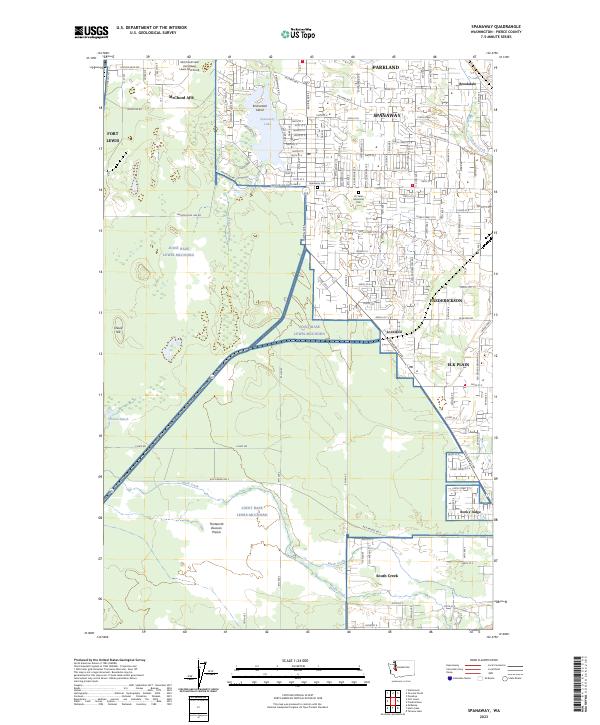
2023 Map of Spanaway
USGS Topo · Published 2023About this map
Spanaway and the surrounding residential communities of southern Pierce County are dominated by the extensive footprint of Joint Base Lewis-McChord. This contemporary survey illustrates the modern suburban landscape of Parkland and Elk Plain as it interfaces with large-scale military infrastructure, including McChord AFB and Fort Lewis. The drainage patterns of Spanaway Creek and Muck Creek define the low-lying terrain, with Spanaway Lake serving as a central recreational landmark.
Find a feature on this map
45 named features on this map. Tap any name to fly to it.
Don’t see what you’re looking for? This feature index may not catch every label — zoom into the map to look around manually.
Map Details
Editions of this 2023 Spanaway Map
This is the sole edition of this map. No revisions or reprints were ever made.
Other maps of this area

1897 · Tacoma
USGS Topo · 1:125,000

1900 · Tacoma
USGS Topo · 1:125,000

1916 · Chehalis
USGS Topo · 1:125,000

1937 · Eatonville
USGS Topo · 1:125,000

1940 · Anderson Island
USGS Topo · 1:62,500

1941 · Tanwax Lake
USGS Topo · 1:62,500

1941 · Tacoma South
USGS Topo · 1:62,500

1944 · Tacoma South
USGS Topo · 1:62,500

1944 · Yelm
USGS Topo · 1:62,500

1944 · Ohop Valley
USGS Topo · 1:62,500